17 Must-Know Terms in Real-Time Tracking and GPS Technology
Drafted with AI assistance and published by the Locate2u Editorial Team. See our editorial policy.
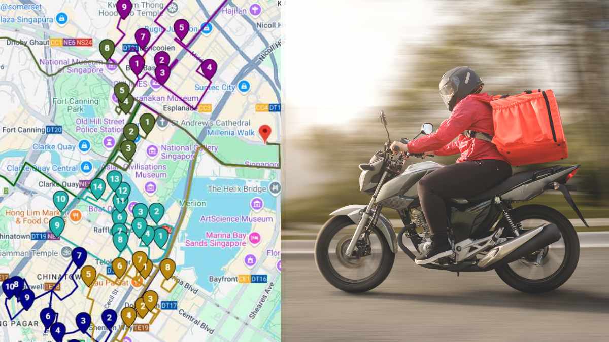
GPS tracking comes with a lot of jargon. Sales sheets talk about pings, fixes, HDOP and CAN bus as if everyone already knows what they mean.
You do not need to be an engineer to run a tracked fleet, but knowing the vocabulary helps you ask better questions and read your reports properly.
Below are the terms that come up most often, each with a plain definition and why it matters to a fleet. First, a quick look at how tracking actually works.
How GPS tracking works on a phone or device
GPS satellites constantly broadcast a signal that says where the satellite is and what time it is. Your phone or tracker does not send anything to the satellites. It only listens.
The receiver measures how long each signal took to arrive and uses that to work out its distance from each satellite. The constellation is arranged so that users can see at least four satellites from virtually any point on the planet, which is enough to calculate a position and the exact time.
Tracking is the second half: the phone app or tracker sends that position over the mobile network to a server, which plots it on a map for your dispatch team.
So a tracker is really two radios working together: a GPS receiver that listens to satellites and a cellular modem that reports back. When people talk about real-time GPS tracking, they mean that loop running every few seconds. If you want the longer explanation, our guide to what GPS tracking is and how it works covers the basics in more depth.
Satellite and positioning terms
1. GNSS
GNSS stands for Global Navigation Satellite System. It is the umbrella term for every satellite positioning system, including the American GPS, Europe's Galileo, Russia's GLONASS and China's BeiDou.
Why it matters: most modern phones and trackers listen to more than one system at once. More satellites in view usually means a faster, steadier position, especially between tall buildings.
2. Satellite constellation
The constellation is the full set of satellites a system uses, spread across several orbits so that coverage is continuous. The US government aims to keep at least 24 operational GPS satellites available 95% of the time.
Why it matters: it explains why GPS works anywhere with a clear view of the sky and struggles in tunnels and parking garages.
3. GPS fix
A fix is the moment a receiver has locked onto enough satellites to calculate a position. "Time to first fix" is how long that takes after the device wakes up. A cold start, with no recent satellite data stored, takes longer than a warm start.
Why it matters: a battery tracker that sleeps between reports needs a fresh fix each time it wakes, and slow fixes drain batteries.
4. A-GPS (Assisted GPS)
A-GPS uses the mobile network to give the receiver a head start, such as which satellites should be overhead and roughly where the device is. Phones also blend in Wi-Fi and cell tower positioning when satellites are hard to see.
Why it matters: this is why a driver's phone finds its position quickly and keeps working, roughly, inside a warehouse.
5. Accuracy and HDOP
Accuracy is how close the reported position is to the true one. According to the US government, GPS-enabled smartphones are typically accurate to within a 4.9 m (16 ft.) radius under open sky, and that accuracy worsens near buildings, bridges and trees.
HDOP (horizontal dilution of precision) is a number the receiver reports about satellite geometry. When the satellites in view are bunched together, the HDOP is higher and the position is less trustworthy. When they are spread across the sky, it is lower and better.
Why it matters: if a van appears to jump across the road on the map, it is usually poor geometry or signals reflected off buildings, which GPS.gov calls multipath. It is not always a faulty device.
Data and connectivity terms
6. Ping and update interval
A ping is a single location report sent from the device. The update interval (or reporting interval) is how often those pings are sent while the vehicle or asset is moving or parked.
Why it matters: shorter intervals give a smoother live map but use more data and battery. Locate2u's live map refreshes vehicle positions every 10 seconds, while battery asset trackers are usually set to report far less often so they last for years.
7. Latency
Latency is the delay between the device recording a position and that position showing up on your screen. It depends on the mobile network, the server and how often the device sends data.
Why it matters: high latency is how a customer sees the driver two streets away when they are already knocking on the door.
8. Cellular vs satellite trackers
Most fleet trackers send data over mobile networks, which is cheap and fast wherever there is coverage. Satellite trackers send data through a communications satellite instead, so they work in remote areas but cost more to run.
Older networks are being switched off, so check the technology inside any tracker you buy. Telstra closed its 3G network on 28 October 2024, and devices that only supported 3G stopped working on it.
Why it matters: good cellular trackers store positions when coverage drops and upload them once they reconnect, so your history has no gaps. Locate2u devices do this, as described on our real-time tracking page.
Vehicle data terms
9. Telematics
Telematics is the broader practice of collecting data from a vehicle and sending it somewhere useful. Location is one part. Speed, harsh braking, engine faults, fuel use and idle time are the others.
Why it matters: GPS tells you where a vehicle is. Telematics tells you how it is being driven and whether it needs attention, which is what turns tracking into fleet management.
10. OBD-II
OBD-II is the standard on-board diagnostics port found under the dashboard of most modern cars and light commercial vehicles. Mechanics plug into it to read fault codes.
Why it matters: a plug-in tracker can use the same port for power and data. Locate2u's OBD2 tracker plugs in without tools and reads fault codes, battery voltage and coolant temperature alongside location.
11. CAN bus
The CAN (Controller Area Network) bus is the internal network that lets a vehicle's computers talk to each other. Trucks and heavy machinery often expose richer data on it than a basic diagnostic port does.
Why it matters: if you want engine hours or fuel level from heavy vehicles, ask whether a tracker can read CAN data for your makes.
Location and activity terms
12. Geofence
A geofence is a virtual boundary drawn on a map around a depot, customer site or restricted area. The system logs or alerts you when a vehicle or asset enters or leaves it.
Why it matters: geofences turn raw location into events you can act on, such as "arrived at site" or "trailer left the yard". We cover practical setups in what geofencing is and how delivery fleets use it.
13. Breadcrumb trail
A breadcrumb trail is the line of past positions a vehicle has left behind, which most platforms let you replay as route history.
Why it matters: breadcrumbs settle disputes. If a customer says nobody turned up, you can replay the route and show exactly where the driver was and when.
14. Dwell time
Dwell time is how long a vehicle or asset stays in one place, usually measured inside a geofence such as a customer site or loading dock.
Why it matters: long dwell times at the same customer often point to slow unloading or waiting for sign-off. That is time you may want to plan for, or charge for.
15. Idle time
Idle time is when the engine is running but the vehicle is not moving. It is different from a stop, where the engine is off.
Why it matters: idling burns fuel for no distance covered. Trip reports that show idle duration per driver make for a specific, fair conversation.
16. ETA
ETA is the estimated time of arrival. In a live system, it is recalculated as the vehicle moves, based on its current position, the remaining stops and traffic.
Why it matters: an ETA that updates on its own is what stops "where is my driver?" calls. Our guide on how to send customers a live tracking link explains how to share it.
17. API and webhook
An API (application programming interface) lets another system ask your tracking platform for data, such as a vehicle's current location. A webhook works the other way: the platform pushes a message to your system the moment something happens.
Why it matters: these are how tracking data reaches your ERP, customer portal or billing system without anyone copying it across. Locate2u's REST API and webhooks can send an event when a delivery is completed or a driver enters a zone.
Which terms matter most
You do not need to memorize every acronym. The useful ones are the terms that change a buying decision or explain a strange result on the map: update interval, accuracy, latency, cellular coverage and the type of vehicle data a tracker can read.
When you compare systems, ask vendors to explain each of these in plain language. Our real-time tracking features checklist is a good next step.
If you want to see how these terms look on your own fleet, request access to Locate2u.

Related Articles
Real-Time Tracking Myths That Hold Fleets Back
Three real-time tracking myths debunked: that it is surveillance, too costly to set up, or unreliable, plus a practical plan to roll tracking out to your fleet.
8 Ways to Cut Fleet Maintenance Costs
Eight ways fleet management software cuts maintenance costs, from predictive maintenance alerts and route optimization to driver monitoring and training.
5 Ways Fleet Management Software Cuts Fuel Use
How fleet management software improves fuel efficiency through smarter routes, driver behavior coaching, less idling, preventative maintenance and telematics.